Sunday, June 6, 2010
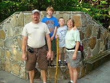
Cathedral Wash, Vermilion Cliffs Arizona
Is a slot canyon that runs from the Vermilion cliffs to the Colorado River. The lower wash is still in Grand Canyon National Park, so we technically hiked to the bottom of the Grand Canyon and back.
Saturday, June 5, 2010
Balanced Rock, Vermilion Cliffs Arizona
Thousands of years ago a huge boulder of conglomerate broke from the cliff above and rolled to a stop here. Since then, at least 6 feet of this slope has eroded away. Ultimately, the softer rock now protected by the umbrella of the harder conglomerate will erode and the boulder will topple again to the ground.
Friday, June 4, 2010
Vermilion Cliffs National Monument, Arizona
We camped at Lee’s Ferry on the Colorado River, this is where the Grand Canyon ends and the Glen Canyon recreation, Lake Powell areas begin. The Vermilion Cliffs are the second "step" up in the five-step Grand Staircase of the Colorado Plateau, reddish or vermilion-colored cliffs. They extend from a location near Page, Arizona, and west for a considerable distance, in both Arizona and Utah.
Thursday, June 3, 2010
Desert View Watchtower, Grand Canyon
Desert View Watchtower is a 70-foot high stone building located on the South Rim of the Grand Canyon. The four-story structure, completed in 1932, was designed by American architect Mary Colter, an employee of the Fred Harvey Company who also created and designed many other buildings in the Grand Canyon vicinity including Hermit's Rest and the Lookout Studio. The interior contains murals by Fred Kabotie
Wednesday, June 2, 2010
South Kaibab Trail, Grand Canyon
We hiked the South Kaibab Trail, it begins south of Yaki Point. Described as a steep trail, the trail head is 7200 feet. We made it to Cedar Ridge 6060 feet, the return trip of 1140 feet you cover in 1.5 miles will have you huffing and puffing! The trail is on the canyon wall and then you follow a ridge down. The views are breath taking!! The first rest area on the hike is Ooh Aah Point, and it is an ooh ahh moment!
You can just see in the photo below, the trail going down the side of the canyon wall.
Jordyn taking a rest in the Juniper trees
Cedar Ridge, was our turn around point. From here you can continue on to Skeleton Point another 3 miles and you drop another 860 feet. The return trip would have been a climb of 2000 feet in just 3 miles!
Our Google Map Location
Tuesday, June 1, 2010
Grand Canyon, Arizona
Grand Canyon National Park is one of the United States' oldest national parks and is located in Arizona. Within the park lies the Grand Canyon, a gorge of the Colorado River, considered to be one of the major natural wonders of the world. The park covers 1,902 miles of area in Coconino County and Mohave County.
This is one of those places that is indescribable unless you are standing here! A camera can’t capture the beauty and enormous size of the canyon.
We stayed on the south rim at camper village, covered in snow once again. The weather changes fast here, we were hiking in t-shirts earlier in the day and ended up in heavy jackets by evening time.
Subscribe to:
Posts (Atom)